The basis of the RadarNetPlus- Project is the X-Band weather Radar Technology The majority of weather Radars
used worldwide operate in the S- and C-band (2.6 to 5.8 GHz). X-band (roughly 8 - 12 GHz) has some advantages for the use-case of RadarNetPlus: Its is economically more feasible
due to smaller antenas and simpler electronic implementation and has a much higher sensitivity for smaller rain droplets (i.e. drizzle). This advantage is also its main drawback: X.band suffers
from a much higher attenuation of the waves traveling through the atmosphere, and hence the range is much more limited. However, in mountain terrain like the Andes, the range of Radar is limited anyway
by blocking the beam, so x-Band is appropriate for this project. Also, the higher sensitivity allows for a better spatial resolution, a fact which supports the observation of the highly heterogeneuos
rainfall distribution in this complex region. And it also is better suited to the needs of small-scale ecological studies, reproducing differences in precipitation on short distances.
Another limitation of the Radars in this economic range is that they supply no Doppler or polarimetric information and have only one scan elevation, so only a constant altitude plan position indicator (CAPPI)
is generated. LEONARDO therefore prefers to call their system a rain scanner.
The DHI LAWR
DHI (Dansk Hydraulisk Institut) of Denmark produced the LAWR (Local area weather Radar) between 1998 and 2015, mainly with the intention to supply a system for the needs of typical urban hydrology
applications. Our system was delivered in 2001 and installed in March 2002 above the ecological research site Reserva Biologica San Francisco to monitor rainfall specifically in the Valley of the
Rio San Francisco, east of Loja.
As a small fun-fact, the system was ordered with a range of 30 km, but shortly after start of operation it turned out, that it offered double the range. During the first years of operation
it was constantly upgraded and quite a few software bugs and hardware-shortcomings were corrected. The chosen site offered almost perfect unobstructed view of the eastern escarpment of the Andes in that
region.
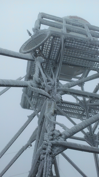
But the site also caused significant stress on all Hardware due to the extremely humid conditions there and the difficult access made maintenance a challenging task. Legal matters forced a longer standstill
in 2008 which left the Radar system inoperable. The whole system was dismantled and the new site El Tiro was chosen, where operation could be resumed in 2012.
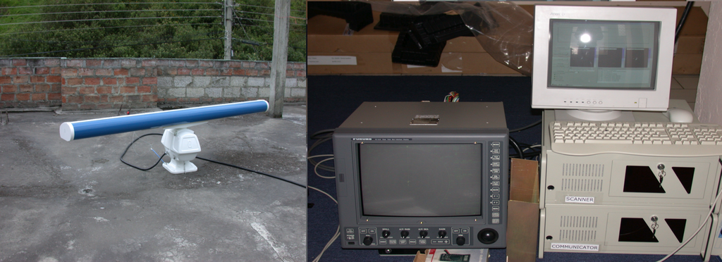
Antenna and head unit (left), FURUNO Radar display and the two attached Computers
The LAWR (as well as the RS 120) is based on a standard marine Radar of the type FURUNO 1500 and the reflectivity information is derived from the video signal normally going into the navigation display
of the Radar.
The video-signal is sampled with 20 Mhz and digitized in polar format to a 10-bit numerical resolution. From these raw images, a proprietary software resamples three cartesian images in 8-bit resolution with
500 m resolution and 60 km range,
250 m and 30 km and 100 m 15 km. The sampling card can be adjusted for sensitivity and low-cutoff, to optimize the signal-to-noise ratio. The output signal is proportional to linear reflectivity but
strongly varies with technical conditions of the system and atmospheric influences. Hence, the signal as is can not be directly converted to reflectivity (nor rain rate), but needs a complex pre-processing.
The limited range of the LAWR is also a consequence of the antena used, which is so robust, that it does not need a radome, but is also not well suited for rainfall observation. With a vertical aperture of
20° (horizontal: 1°), the strong attenuation of X-band-waves is even more expressed and during stronger rain storms the useful range sometimes shrinks to 30 km.
The Gematronik / LEONARDO RS 120
LEONARDO (former: SELEX Gematronik) of Germany improved strongly on the basic marine Radar from FURUNO by combining the basic head unit with a better-suited pencil-beam antenna.
This improves the attenuation susceptibility strongly, thus supplying the RS 120 (Rainscanner with 120 cm Antenna diameter) with a nominal range of 100 km, that even in strong rainstroms does not drop below 60 km.
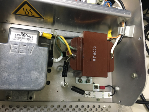
Also, the original Radar display from FURUNO is replaced by a newly designed processing and control board and some minor modifications are done to adjust the signal-to noise ration to the requirements of
precipitation observation.
The system has a much more elaborate scan strategy and uses a slower antenna rotation. The preprocessed output consists of polar 8-bit data of reflectivity (dBZ) where major geometric corrections
are already applied in the manufacturer supplied software-tandem of RainView and RainViewAnalyzer. Raw data as well as derived cartesian products (Plan position indicator) for display are stored
according to the user-configurable settings.
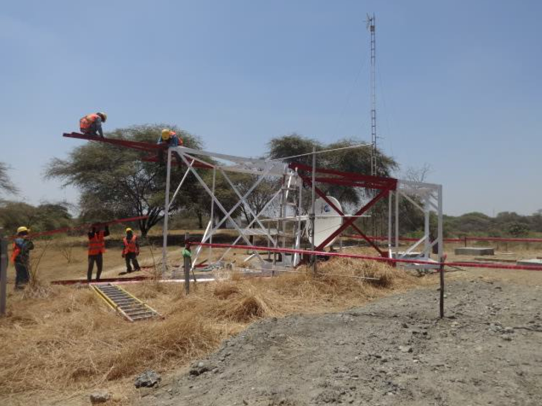
All three systems currently in use in RadarNetPlus are close to identical. Due to the much larger antenna, RS120 needs a Radome and a stronger support structure.
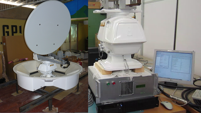
RS 120 Antenna and head unit (left), Control unit and Data processor (right)
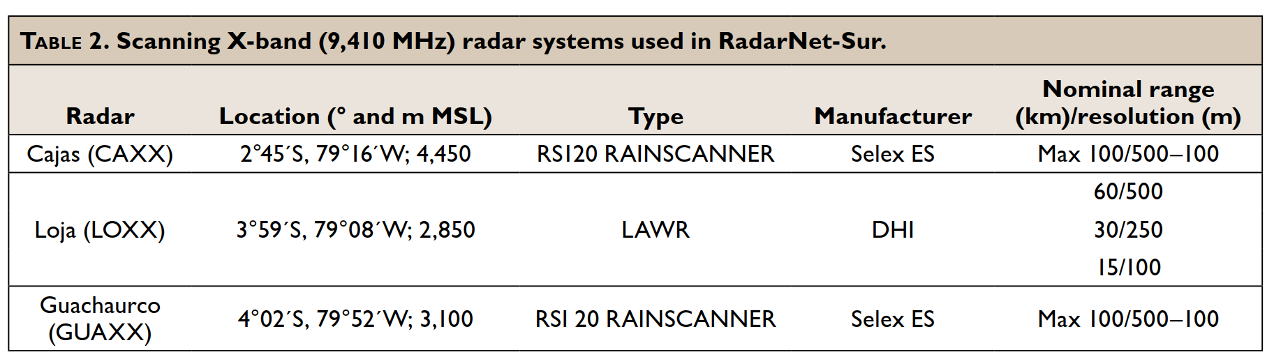
Technical specifications of the Radar Systems. The new system in Piura (S05°10' / W080°38' / 42 m) has identical values