In July 2018 the new Project: "High-resolution Radar analysis of precipitation extremes in Ecuador and North Peru and implications of the ENSO-dynamics" was approved by DFG to
Principal Investigator Rütger Rollenbeck for an initial duration of three years
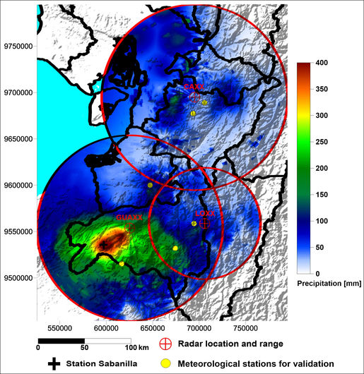
RadarNetPlus is the follow-up of RadarNetSur and extends the observed area by almost 35000 square kilometers with the implementation of an additional RS120 Radar instrument in Piura / North Peru.
The aim of RadarNetPlus is the observation and analysis of regional precipitation extremes and the associated atmospheric dynamics of circulation in the meteorologically complex transition
zone from the coastal plains of southern Ecuador and northern Peru across the Andes to the eastern foot zone of the mountains. A longer time series from 2014 to 2020 of the weather radar systems
of RadarNetSur allows to identify and explain relevant spatio-temporal patterns like persistent, transient end episodic cycles. The diurnal cycle is shaped by small-scale
local circulation systems like the mountain-valley-, the land-sea-breeze or the confluence of synoptical flows and katabatic winds. They lead to a characteristic pattern of precipitation genesis,
which cannot be registered by point observations. In Radar imagery they show up in detail and their spatial distribution will be visible. This enables to understand the high heterogeneity of the
diurnal cycle and the occurrence of extremes as dependent on the topography.
Dependent on the synoptic wind situation such patterns also change their location. This superordinate control in its spatial extent can only be observed by weather radar by deriving typical
spatio-temporal patterns in relation to the larger-scale weather situation. As a result, detailed maps of the diurnal and annual cycle of precipitation and areas with a high potential for
extreme events are generated.
The arid climate of the coastal regions is caused by large scale subsidence, but episodically deep convection occurs. Convective cells with extreme precipitation are propagating eastwards
and cause local flooding, more frequently in the southern sub-regions. Genesis and typical pathways are analyzed by using profiles of precipitation intensity and associated dynamic convergence
zones, which form during such events. The movement profile of such dynamic convergence zones is indicative for the relation of their genesis to the synoptical and spatial context and shows areas
of elevated risk for extreme events. Also, regional differences of the whole study region caused by topography and general exposition are shown.
Regional differences are also an important aspect of the longer-term influence on the genesis of extreme precipitation. For each sub-region the effect of temperature anomalies of the costal
(El-Niño-region 1+2) and central pacific (EN-region 3+4) will be analysed, especially their modifying influence on local precipitation enhancement by topographic and synoptic factors.
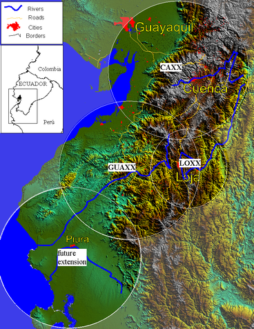
RadarNetPlus will cover about 90000 square kilometers in Ecuador and Peru
The previous Project RadarNetSur was started in 2012 as Technology Transfer Project. It was aimed to apply knowledge to a wider area which was gained in the very first ecuadorian Project
PREDICT (Precipitation dynamics and chemical properties) executed by the Universität Marburg. It scope was to implement Radar Technology at two additional sites in Cuenca and
the arid south-west of the Province of Loja.
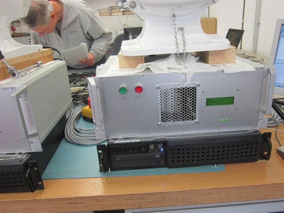
The assignation and preparation of the sites as well as manufacturing and shipping of the Radars took some time. Only the LOXX Radar system, which had been used previously in the PREDICT-Project
was ready in the first year, after it was completely refurbished to serve at its new site El Tiro on the mountain pass between Loja and Zamora. This system went online in October 2012
under supervision from the UTPL and supported by LCRS. The site is perfectly chosen to observe the Valley of the Rio San Francisco, where long-term ecological research is executed on
behalf of the german research platform RESPECT.
The western half of the Radar range allows for a detailed monitoring of precipitation above all of the provincial Capital Loja and also the Muncipial Airport in Catamayo.
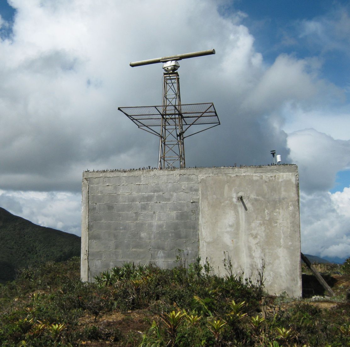
Radarsite LOXX shortly after installation
The first additional Radar to come into operation was GUAXX in March 2014. Sited at
the Cerro Guachaurco at 3000 m above sea level, this Radar system has a superior overview above the whole area of South-West Ecuador from the Andes to well beyond the
Pacific coast, also covering parts of North Peru.
Radarsite GUAXX shortly after installation
Gobierno Provincial de Loja took over the responsibility for the preparation, realization and operation of this system, strongly supported by the
local scientific coordinator Andreas Fries affiliated to the LCRS of Universität Marburg and the Universidad Tecnica Particular de Loja.
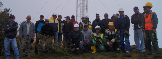
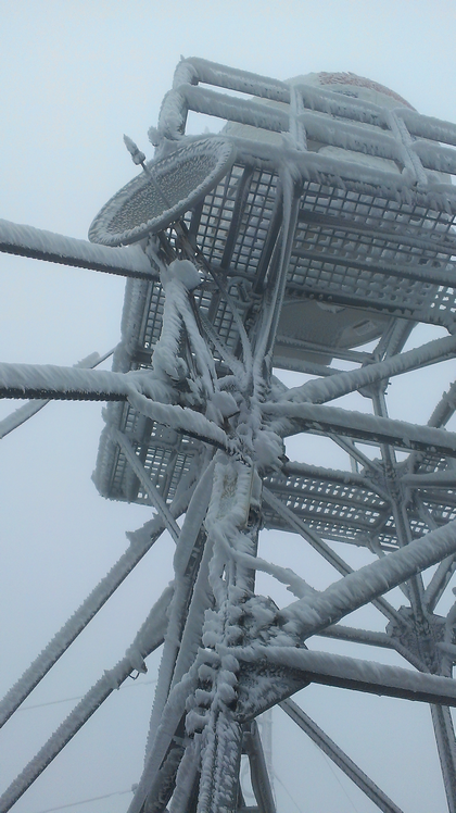
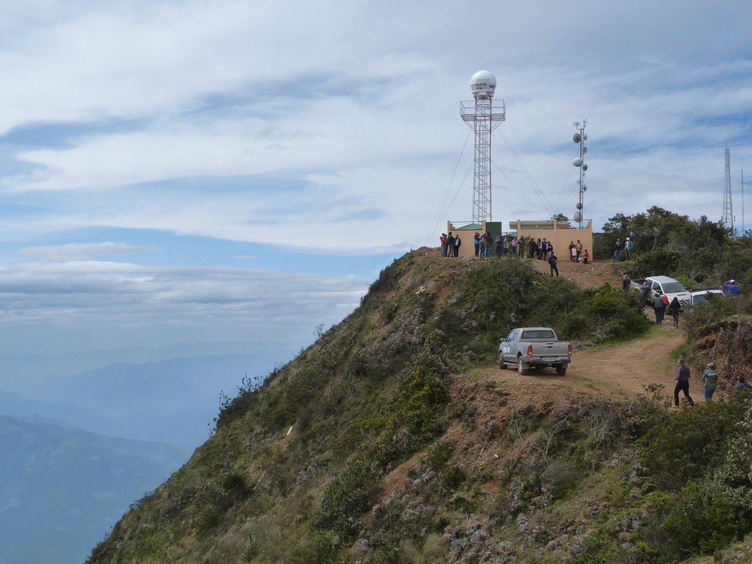
In March 2015, the demanding task of setting up CAXX in the National Park Cajas was finished. The 4550 m high Cerro Paragüillas as chosen site makes this the highest weather Radar in the world -
and the extreme conditions there with low air density, high wind speeds and frequent cloudiness with occasional icing fog makes the additional delay understandable. In charge of setup and operation is
ETAPA EP the muncipial utility and telecommunication provider of Cuenca. The chief responsible scientist Mario Guallpa was supported by staff of ETAPA, the Universidad de Cuenca and of course Andy Fries.
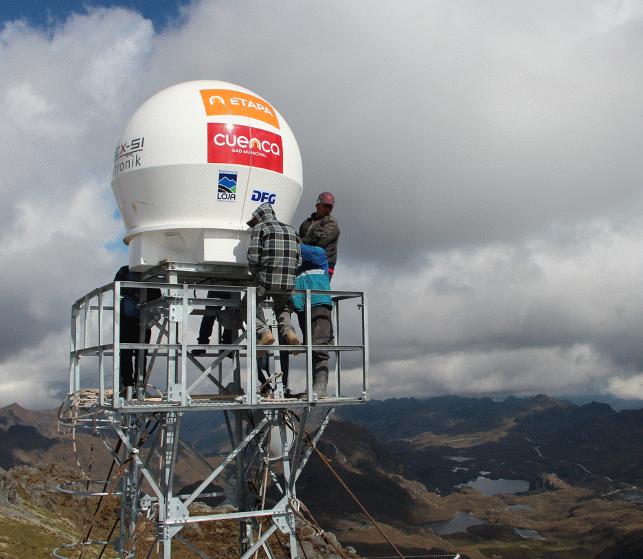
Radarsite CAXX: Finalizing the installation at 4550 m
After the installation of the Radars, the communication and telemetry was added, passing the received radar images each five minutes to a central server operated by GPL in Loja. Data is also stored
in Cuenca at ETAPA, at the UTPL and the LCRS in Germany.
The start of operation came just in time, to monitor a heavy flooding event on the Pacific coast in South Ecuador. Although not uncommon in this region, the local population there suffered many
fatalities and strong damage to public infrastructure and private property occured. It is one goal of RNP, that Radar monitoring of developing heavy rain events helps to mitigate the impact of such episodes.
The March 2015 flooding event as monitored by RadarNetSur
The first weather Radar installed in Ecuador was the system of the type DHI LAWR now operating as LOXX. In 2002 this was installed with the purpose to improve high resolution rainfall measurement
especifically for the ecological research work going on in the 900-hectare area Reserva Biologica San Francisco. Here, a common effort of german Universities together with ecuadorian partners is aimed at
studying a broad array of ecological factors and phenomena on multiple scales and for extended periods.
The DHI LAWR was deployed to the highest Mountain in that research area, the Cerro de Consuelo (3080 m). The extremely humid climate of this mountain and the semi-prototype state of the instrument
made this a difficult task, also considering, that initially data had to be downloaded to CD´s weekly by hand and carried four hours downhill in a backpack to the research station. Nevertheless, six good
years of Radar data could be obtained and important methodological progress was made in adressing the operational circumstances of weather Radar in tropical mountains.
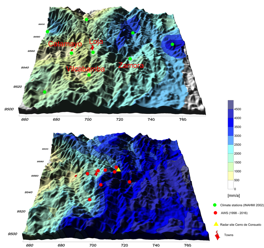
Coverage of LOXX Consuelo comparing the interpolated observations of meteorological stations and a calibrated Radar product for 2002 - 2008
RadarNetPlus is build on almost 18 years of experience with weather Radar in South America and hopefully will contribute to a deeper understanding of the regional circumstances that affect temporal and
spatial rainfall distribution. Especially, conditions that cause heavy rain events are important to understand in this region of the world which is the one single region most affected by the ENSO-phenomenon.
In the meantime, several other entities have joined the projects initiative. Beyond the founding members the Universität Marburg with the LCRS, the National weather service of Ecuador INAMHI and the UTPL,
now ETAPA EP in Cuenca is a reliable partner suppported by the Universidad de Cuenca. In Loja GPL has passed operational duties to UTPL, but still contributes with administrative and logistics support.
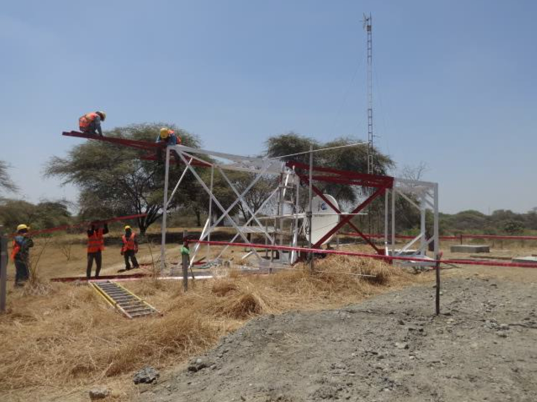
With the association of the Partners at UDEP in Piura North-Peru, a whole array of supporters are now involved: the Ministerio de la Produccion in Lima, who has funded the major part of the new Radar in Piura,
SENAMHI, the national weather service of Peru, the instituto Geofisico (IGP) de Peru,
the University of Newcastle in the UK, and the national company Petroperu as well as Asociacion Peruana de productores y exportadores de Mango (APEM).
Cooperation Partners in RadarNetPlus