


"Climatology": CorsiClimAte – Seasonal and topographic partitioning of vapor transport, cloud and precipitation in Corsica, with special reference to PBL height [funded by DFG]
Project staff:
Abstract:
 The project aims at exposing the relationship of local breeze systems and large-scale synoptic circulation patterns at different terrain expositions and altitudes to investigate the precipitation variability and origins of water vapour in Corsica. A classification of typical weather types affecting Corsica and the development of the planetary boundary layer (PBL) will be used to analyse their interplay. A combination of remote-sensing and ground-based observations will contribute to the characterisation of the diurnal cycle of precipitation dynamics. Additionally, back-trajectory modelling will be applied to examine atmospheric pathways of air masses and water vapour for precipitation formation. The underlying mechanisms of local-scale and large-scale wind dynamics inducing the precipitation development will be reflected in numerical simulations. At present this complex interplay has not been investigated for Corsica but could be a requirement to correctly interpret tree rings and isotops measurements of water bodies in different altitudes and expositions, and to relate rainfall time series to tree-ring data.
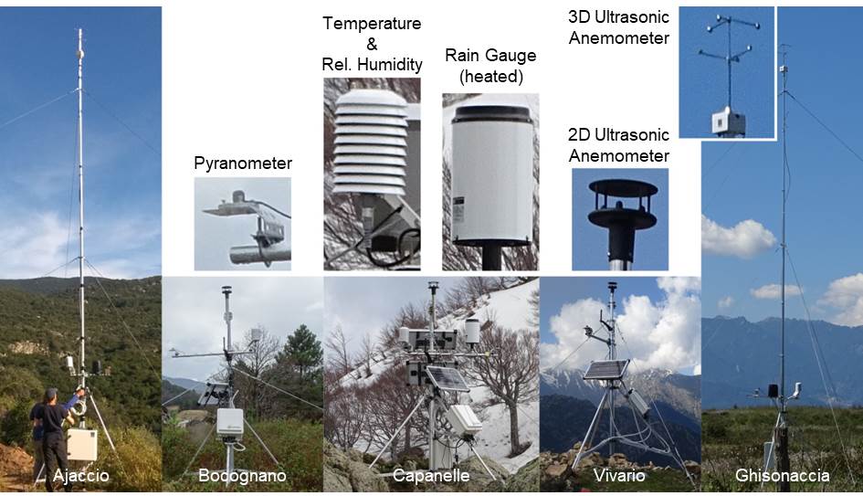
Along an altitudinal transect from west to east ground-based measurements by five automatic weather stations (AWS) provide the required temporal high resolution meteorological parameters. These parameters encompass air temperature, precipitation, wind field, relative humidity, global radiation, as well as soil moisture and soil temperatur. Due to the occuurence of snow during the winter season at Capanelle the rain gauge of this AWS is heated. To account for the turbulent wind field for PBL analysis and local sea-breeze-systems the coastal AWSs (Ajaccio and Ghisonaccia) are equipped with a 3D-ultrasonic anemometer. The measurements require a height of 10 meters, while the remaining AWSs in the mountainous areas (Bocognano, Vivario and Capanelle) have a height of approximately 3 meters with a 2D wind anemometer. All stations are equipped with solar panels for the power supply and are anchored to the ground by three and six tensioning cables, respectively. The data are automatically transmitted via telemetry to a server for post-precessing.
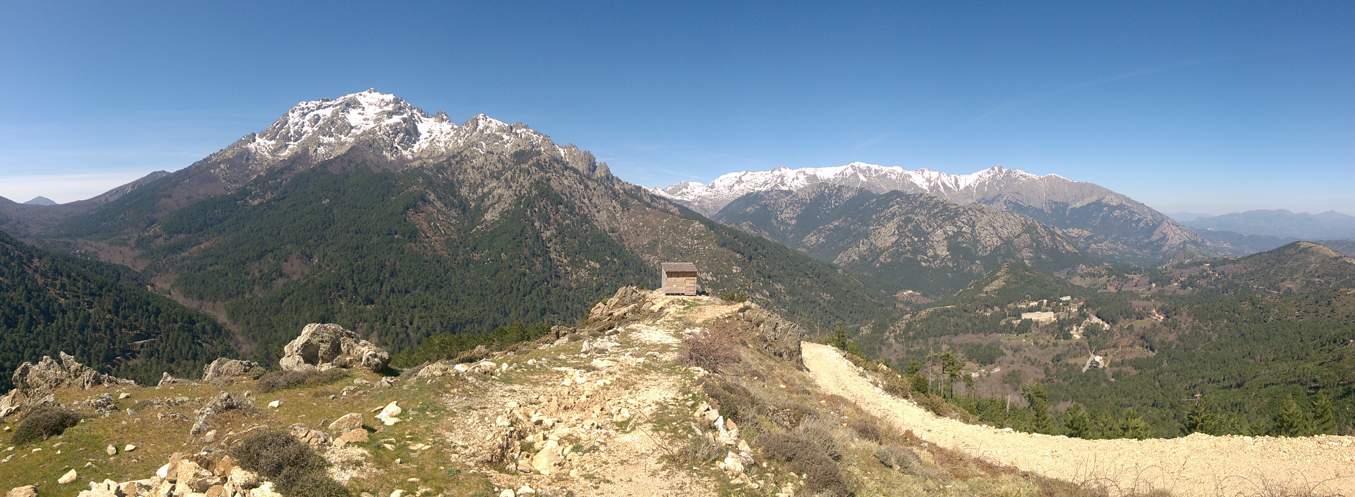 |
| Surrounding Area of Station 'Vivario' |
Publications and poster presentations:
2019 - Knerr, I.; Trachte, K.; Garel, E.; Huneau, F.; Santoni, S.; Häusser, M.; Juhlke, T.; Szymczak, S. & Bendix, J. (2019-10-27). Wettertypabhängige Grenzschichtbedingungen auf Korsika - Entwicklung und Ausbildung der planetaren Grenzschicht. Presented at Jahrestagung des AK Klima, Jesteburg/Germany.
2018 - Knerr, I.; Trachte, K.; Garel, E.; Huneau, F.; Santoni, S. & Bendix, J. (2018-10-28). Raumzeitliche Niederschlagsmuster auf Korsika - Entwicklung und Ursachen von Starkregenereignissen. Presented at Jahrestagung des AK Klima, Schney/Germany.
- Knerr, I.; Trachte, K. & Bendix, J. (2018-04-13). Variability of precipitation along a west-east gradient in Corsica: A case study from early December 2017. Presented at EGU, Vienna/Austria.
2017 - Knerr, I.; Trachte, K. & Bendix, J. (2017-10-29). Analyse von großskaligen und lokalen Einflüssen auf die Niederschlagsvariabilität entlang eines West-Ost Höhentransekts auf Korsika. Presented at Jahrestagung des AK Klima, Rauischholzhausen/Germany.